
DEW4.2. What Can You See From 400 Miles Above the Earth?
Looking at a satellite or aerial photograph requires us to think about how a view of something familiar, for example, of a school building viewed from the street, alters when seen from above. We experience this somewhat on the nightly news, when we see the weather report and the clouds above the geographic US with state outlines.
Many of us have had the experience of being on an airplane, and so can understand that as you go higher, features on the Earth become smaller, and that the roof of a building may appear to be just a rectangle when viewed from above. It is important to understand how a scale of feet or miles on an image can help you understand what you are seeing. The concept of zoom is commonly used in many video games, as well as on digital cameras and digital picture display programs, browsers and even Microsoft Word. Zooming is used in this investigation.
Materials
- Google Earth
- Slide sets:
- Introduction (SpatialA.pdf)*
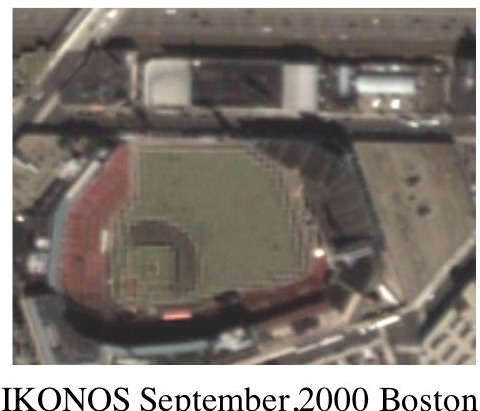
- Zooming an IKONOS image (SpatialB_IKONOS.pdf)**
- Teacher Guide (pdf)
- Glossary of Spatial Remote Sensing Terms
- Supplemental information about three different satellites:
*intended for teacher projection, but could be used in a student computer lab with teacher narration for the first 9 slides. The written student exercises begin at slide 10.
**can be used by an individual student, or a student group. There are three areas of focus within the powerpoint, so 3 student groups could be set up.
What To Do
- Use Google Earth to view your home or school from altitudes:
- 100 feet (~30 meters)
- 1000 feet (~300 meters or 0.3 km)
- 10,000 feet (~1.9 miles or 3 km)
- 100,000 feet (~19 mi or 30 km)
- 1,000,000 feet (~190 mi or 300 km)
- 2,000,000 feet (~400 mi or 610 km)
What surface features can you identify at each altitude?
2. View the Introduction slide set. Use the Teacher Guide for explanations and insights into answers to questions. Refer to the glossary for any terms as needed.
3. View the Zoom An ICONOS Image slide set. Use the Teacher Guide for explanations and insights into answers to questions. Refer to the glossary for any terms as needed.
4. Read the supplemental information documents about ICONOS, Modis, and Landsat satellites.