DEW Partners
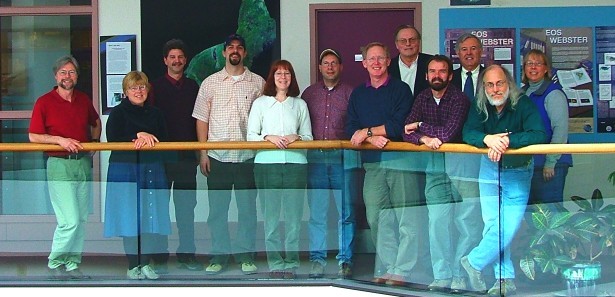
Staff from seven institutions are incorporating their diverse talents to develop the activities, guides, resources, and information for the NASA grant project Measuring Vegetation Health that produced the Digital Earth Watch materials.
Collaborating Institutions
Museum of Science Boston
Founded in 1864 as the New England Museum of Natural History, the museum expanded to become the first to embrace all the sciences under one roof (1951). Because of its breadth of science exploration, the name changed to the Museum of Science. Beginning in 2002, the Museum of Science expanded its mission to engage people in engineering and technology activities. The concept of Measuring Vegetation Health grew from this vision, focusing on the connection of improved scientific understanding through advancing engineering and technologies in remote sensing, communications, and image processing. The Museum also has a number of programs that focus on teacher professional development and has created the Educator Resource Center, in which staff and teachers have reviewed and summarized the best standards-based science, technology and engineering resources for your classroom.
Exhibits and Programs at the Museum of Science that relate to Measuring Vegetation Health
- Remote Sensing exhibit: Use today’s satellite images to monitor Earth.
- Seeing the Unseen exhibit: Explore how we use the electromagnetic spectrum in science
- Light House exhibit: Hands-on experiences with light and color
- Butterfly Garden: For simulations of what butterflies see, visit this Landsat website.
- Cahners Computer Place: Check out their “Info Bytes” to explore color, pixels, and many other aspects about computers.
- Human Body Connection: In particular, during days in which eyes are the topic.
- Summer Courses: Using Light to Look at Our World, Grades 6-9.

EOS-WEBSTER (a WEB based System for Terrestrial Ecosystem Research), University of New Hampshire Durham, NH, is a digital library of Earth Science data serving the needs of both the Earth System Science community and the general public. EOS-WEBSTER was developed through a $3.5 million dollar grant from NASA and is now supported by the University of New Hampshire’s Institute for the Study of Earth, Oceans and Space. Our data holdings can be searched spatially, temporally, or by keyword, free text, or collection name. We have distributed over 150,000 data products to our users world-wide since 1999.
See their Landsat Clic ‘N Pic for finding free Landsat images for much of the United States.
EOS-WEBSTER Collections of interest to MVH users:
- Educational Image Subsets for the Forest Watch Program IKONOS Landsat scenes for the entire US for 1990 and 2000 MODIS satellite data for the USA SPOT-VEGETATION indices
- NCAR climate change in the 21st century data Global Landuse Change US County Crop data from 1970 Global Demographic (population and water demand) data
Forest Watch University of New Hampshire,Durham, RH
Forest Watch is a New England-wide environmental education program designed to introduce both teachers and their students to field, laboratory, and satellite data analysis methods for assessing the state-of-health of local forest stands. Forest Watch provides workshops which are designed to help K-12 and post-secondary teachers introduce students to selected hands-on techniques, based on UNH research methods, for evaluating the health of white pine (Pinus strobus)—a bioindicator for ground-level ozone. Through the Forest Watch program, students become actively involved in doing meaningful scientific research, and in the process, collect and compile data useful to UNH researchers in their on-going regional survey of forest health. This program was introduced in 1992 to six New Hampshire schools. Participating schools are from New Hampshire, Maine, Vermont, Massachusetts, Connecticut, Rhode Island and Maryland.
The Forest Watch program grew out of research conducted by Dr. Barry Rock of Complex Systems Research Center at the University of New Hampshire (UNH); his research in the early 1990s focused on assessing the relative sensitivity of several bioindicator species to controlled levels of ozone exposure in order characterize responses at the visual, physiological, and spectral levels. Rock and his associates demonstrated that white pine needle response to elevated levels of ozone above 80 ppb (parts per billion) occurred within one hour of exposure. This work led to the identification of many other potential bioindicator species for ozone exposure, including black cherry, dogbane, milkweed, bigleaf aster and white ash. White pine was selected for study in the Forest Watch program because it was shown to be sensitive to ozone exposure, it occurs commonly across New England (often near schools), and it exhibits characteristic needle symptoms year-round. Students participate in three types of activities in Forest Watch, each patterned after activities conducted by professional environmental scientists. The activities include:
- forest stand assessment,
- laboratory-based assessment of damage symptoms, and
- image processing/data analysis.

College of Education and Human Development, University of Southern Maine, Portland and Gorham, ME
USM’s College of Education and Human Development is Maine’s leading public institution for educating teachers, school administrators, and human resource professionals. The College is firmly grounded on a rich history that dates back to the Gorham Normal School, established by the state of Maine in 1878 to educate teachers and establish teaching norms. Today, the College of Education and Human Development has a mission of preparing educators and human development professionals for responsible service that is as relevant to society today as it was more than a century ago.

Indiana State University Terre Haute, IN
Science Education and Research Opportunities for Students (SEROS)
The Indiana State University (ISU) partner of the greater Digital Earth Watch (DEW) group focused on developing two major modules that contain high levels of remote sensing. Spectral data (e.g. light) collected through remote sensing is used to extract important Earth feature information. The module Light Interactions with Earth Features (or the “Spectral Module”) focuses on use of satellite and airborne images that interpret through visual and/or computer-aided methods.
The companion module Earth and Environmental Changes from Volcanic Activity (or the “Temporal Module”) was also developed by the ISU DEW/MVH group. Biological and physical changes over time (1979-2005) are explored by students visually interpreting pre-prepared satellite images, aerial photos, ground-based photos, and a variety of published maps/models of the environment through directed hands-on exercises and activities. For access to the full modules, you must set up a free account.
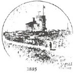
Blue Hill Observatory Milton, MA
Blue Hill Meteorological Observatory, located at the top of a scenic mountain range south of Boston, is a unique American institution. It is home to the oldest continuous weather record in North America. Founded in 1885 by Abbott Lawrence Rotch as a private scientific center for the study and measurement of the atmosphere, it was the site of many pioneering weather experiments and discoveries. The earliest kite soundings of the atmosphere in North America in the 1890s and the development of the radiosonde in the 1930s occurred at this historic site.
Lawrence Hall of Science University of California, Berkeley Berkeley, CA
Lawrence Hall of Science’s Global Systems Science (GSS) project provides materials including books and investigations for high school students to learn about science in the context of today’s environmental issues that require thinking of the world in terms of systems. The materials can support an integrated science course or supplement traditional discipline-based courses (physics, biology, chemistry, Earth science, or social studies). Measuring Vegetation Health activities are being incorporated in the GSS books: A New World View, Ecosystem Change, and Ozone.

